
The landscape of real estate is constantly evolving, driven by technological advancements and shifting consumer expectations. For years, the process of buying and selling homes remained remarkably consistent, anchored by traditional methods that, while functional, often fell short in providing a truly comprehensive and engaging view of a property. However, the advent of innovative technologies is reshaping how we discover, evaluate, and ultimately decide on our next home. Among these, drone technology stands out as a transformative force, moving beyond the static images and limited perspectives of the past to offer a dynamic, immersive, and incredibly informative experience.
The Stagnation of Traditional Real Estate Marketing
For too long, real estate listings have followed a predictable and often uninspiring format. The Multiple Listing Service (MLS) record, while a vital database for agents, often presents an archaic, text-heavy interface that struggles to capture the true essence and appeal of a home. Furthermore, the quality of traditional photo and video tours can vary dramatically. Some listings feature professional, high-quality visuals, while others rely on amateur photography that fails to do justice to the property, hindering a potential buyer’s ability to truly visualize themselves in the space.
This inconsistency and lack of comprehensive visual information often lead to frustration for prospective buyers. They might spend precious time visiting properties that, upon arrival, don’t meet their expectations simply because the online representation was inadequate. For sellers, this means longer market times and potentially lower offers, as their property isn’t showcased in its best possible light. The traditional approach, with its inherent limitations, created a significant gap in how properties could be effectively presented to a discerning audience.
Early Steps Towards a Bird’s-Eye View: Digital Maps and Portals
The digital revolution did bring some initial improvements. Google Maps, for instance, dramatically changed how people could assess a property’s location and surroundings. Suddenly, buyers could virtually explore the streets, identify nearby amenities, and understand the general layout of a neighborhood without ever leaving their computer. This was a monumental leap forward from simply looking at a static map.
Pioneering real estate portals like Zillow, Trulia, and Redfin were quick to capitalize on this shift. They integrated mapping technology and introduced features like bird’s-eye views and Street View, providing a more contextual understanding of a home. These platforms offered an unprecedented level of accessibility, allowing users to scroll through properties, see their proximity to schools, grocery stores, and transport links, and even get a basic feel for the neighborhood’s vibe. Google Earth further pushed the boundaries with its 3D renderings, offering a glimpse of what a fully immersive property viewing experience could become.
While these innovations were revolutionary for their time, they still had their limitations. Google Earth’s 3D models, while impressive, could often be rough, outdated, or lack fine detail. Navigating these platforms could sometimes be tedious, requiring multiple clicks and adjustments to get a proper understanding of a home and its immediate surroundings. The visuals, while helpful, were often static or pre-rendered, lacking the dynamic, real-time perspective that truly brings a property to life. There was a clear need for a more dynamic and personalized viewing experience that could bridge the gap between digital exploration and real-world understanding.
Drones: A Game-Changer in Property Visualization
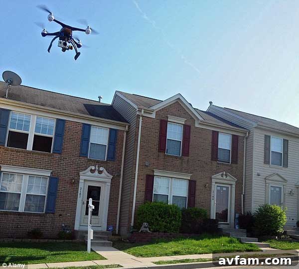
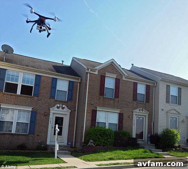
This is precisely where drone technology has stepped in, ushering in a new era for real estate marketing. No longer are buyers confined to imperfect 3D renderings or static street-level images. Drones offer an unparalleled ability to capture stunning, high-definition aerial photography and cinematic video footage, providing a comprehensive and dynamic perspective of a property that was previously impossible to achieve. From expansive estates in rural settings to urban developments, drones are transforming how potential buyers visualize their next investment.
The utility of drones in real estate extends far beyond simple aerial shots. They provide:
- Dynamic Aerial Footage: Smooth, professional video tours that glide around a property, showcasing its architecture, landscaping, and unique features from every angle. This creates an emotional connection and a sense of “being there” that static photos simply cannot replicate.
- Comprehensive Property Overview: Drones can capture the entire property, including the roof, boundaries, and surrounding land, offering a level of detail that is invaluable for understanding the full scope of an investment. This is particularly useful for larger lots, commercial properties, or homes with intricate architectural designs.
- Unrivaled Neighborhood Context: Imagine watching a two-minute video clip that not only showcases the home but then pans out to reveal the surrounding neighborhood, highlighting the exact distance to the nearest school, grocery store, park, or train station. This goes significantly beyond what a static map can offer, providing crucial insights into the lifestyle associated with a property.
- Unique Perspectives and Views: Drones can capture breathtaking views that might not be visible from ground level, such as ocean vistas, mountain backdrops, or city skylines. They can also illustrate how natural light hits different parts of the property throughout the day, an important consideration for many buyers.
- Access to Hard-to-Reach Areas: Drones can safely inspect rooftops for damage, survey large parcels of land, or provide views of properties that are otherwise inaccessible or difficult to photograph effectively.
- “Virtual Open House” Capabilities: Combining aerial footage with interior walkthroughs creates a seamless virtual tour experience, allowing potential buyers to virtually navigate the property and its environment from the comfort of their home, reducing the need for preliminary physical visits.
The adoption of drones in real estate is rapidly gaining traction globally, from Australia, where they are being used to scout new properties, to North America and Europe. As the Daily Mail pointed out, this is only the beginning of a profound shift in property marketing.
Beyond the Basics: Advanced Applications of Drone Technology in Real Estate
The capabilities of real estate drone photography extend far beyond simply capturing pretty pictures. Advanced applications are emerging that further solidify drones as indispensable tools in the modern real estate market:
- Luxury Property Marketing: For high-end homes and expansive estates, drones are essential. They elegantly capture vast landscapes, unique architectural details, swimming pools, tennis courts, and guest houses, showcasing the full grandeur of a property in a way no ground-level photography ever could.
- Commercial Real Estate Insights: Drones are invaluable for commercial properties, industrial parks, and undeveloped land. They can provide comprehensive site surveys, illustrate access roads, highlight proximity to major highways, and even help potential investors visualize future development possibilities.
- Construction Progress Monitoring: For new builds and master-planned communities, drones can track construction progress, providing developers and potential buyers with regular updates and a clear visual timeline of the project from conception to completion.
- 3D Modeling and Virtual Reality Integration: Advanced drone data can be used to create highly accurate 3D models of properties and land. When integrated with virtual reality (VR) or augmented reality (AR) platforms, these models offer truly immersive virtual tours, allowing buyers to “walk through” a property and its surroundings with unprecedented realism.
- Rural and Remote Property Showcases: Properties located in remote or rural areas often present challenges for traditional photography due to their sheer size and lack of accessible vantage points. Drones effortlessly overcome these hurdles, providing stunning aerial views that highlight the land’s features, boundaries, and relationship to the natural environment.
The Competitive Edge for Real Estate Agents
For real estate agents, embracing drone technology is not just an option; it’s rapidly becoming a necessity for staying competitive in a crowded market. This advanced tool provides a distinct advantage:
- Differentiation from Competitors: Agents utilizing drone services immediately set themselves apart. They signal to clients that they are forward-thinking, tech-savvy, and committed to providing the best possible marketing for their listings.
- Enhanced Client Value Proposition: By offering superior visual content, agents provide their clients with an invaluable tool to evaluate properties more effectively. Buyers feel more informed and confident in their decisions, leading to a smoother, faster sales process.
- Faster Decision Making: When buyers have access to detailed aerial videos and high-resolution images, they can make more informed decisions before even stepping foot on the property. This reduces wasted viewings for both the buyer and the agent, streamlining the entire process.
- Increased Engagement and Reach: Eye-catching drone photography and videos attract significantly more attention online. Listings with such content tend to garner more clicks, shares, and inquiries, expanding the reach to a wider audience, including out-of-town or international buyers who rely heavily on virtual tours.
- Professional Image: Presenting a property with professional aerial visuals elevates an agent’s brand. It demonstrates a commitment to excellence and innovation, fostering trust and credibility with both sellers and buyers.
Here’s an excellent example of how drone technology can be used to showcase a property, offering a comprehensive and engaging house tour in Westlake Village:
Navigating the Legal and Ethical Landscape of Drone Use
While the benefits of drone technology are undeniable, it’s crucial to acknowledge the regulatory and ethical considerations involved. Operating drones for commercial purposes, such as real estate marketing, typically requires specific certifications and adherence to national aviation authority guidelines (e.g., FAA in the United States, CASA in Australia). Professional drone operators are trained not only in flying but also in understanding airspace restrictions, privacy laws, and safety protocols.
Privacy is another paramount concern. While capturing the beauty of a property, operators must be mindful of neighboring homes and residents, ensuring that footage does not infringe on personal privacy. Ethical considerations also extend to transparent disclosure about the use of drones to all parties involved. By employing certified and reputable drone service providers, real estate agents can ensure compliance and maintain professionalism, protecting their clients and their reputation.
The Future is Aerial: Integrating Drones into Standard Practice
The journey of real estate listings from static images to interactive, dynamic experiences is far from over, but drones represent a monumental leap forward. They have effectively transformed what was once a tedious and often opaque process into an engaging and highly informative one. For buyers, the ability to virtually explore a property and its surroundings with such clarity and detail saves time, reduces uncertainty, and fosters greater confidence in their purchasing decisions.
For sellers, drone marketing significantly enhances their property’s appeal, helping it stand out in a competitive market and potentially leading to faster sales and better offers. And for real estate agents, drones are not just a tool but a strategic advantage, enabling them to provide superior service, differentiate their brand, and truly elevate their marketing game. As technology continues to advance, we can expect drones to become an even more integrated and standard part of the real estate transaction, perhaps even merging seamlessly with augmented and virtual reality to create truly hyper-realistic property viewing experiences. The future of real estate is undoubtedly soaring, and drones are leading the way.